Summary: Automatic Mapping of Willow Bushes with the Wingtra Drone
This is a short summary of the initial report “Finse Willow Experiment: Automatic Mapping of Willow Bushes with the Wingtra Drone”, and reflects the automation part of the Drone-Willow-Bumblebee project. This summary outlines the experimental methods used for automated mapping of willow bushes in the Western Norway mountain plateau. Details of the original report are omitted and sections are merged to better fit this public web-page. Many people have contributed to the whole of the project, including Ørjan Totland, Suzette Flantua, Augusto Lima, Sjur Barndon, Savanna Nylund, Ingrid Haukereid, and Léonard Saint-Arnaud.
1 Overview
Two species of willows populate the surroundings of Finse, Norway: Salix lanata and Salix glauca. They are thought to be important to pollinators, and it is unclear how their spatial extent has changed in the last decades due to climate change.
This report presents experimental method to map willow bushes in the Norwegian mountain plateau. The method is based on a deep learning model, high-resolution drone imagery, and field sampling. Preliminary results show that the machine learning model can effectively delineate the willows in unseen images, thus demonstrating it could be used operationally on a larger scale.
2 Study Area
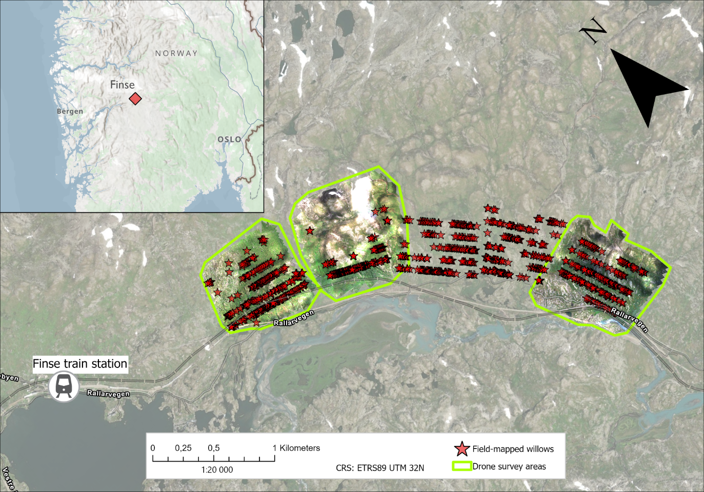
The study area is made of five zones, chosen in relation to the M.Sc projects of Savanna and Ingrid. We conducted a series of field transects on 24–25 July 2025, using an ArcGIS FieldMaps project to geolocate willow bushes. Out of the five zones, three were covered by our drone survey, covering about 2 000 000 m².
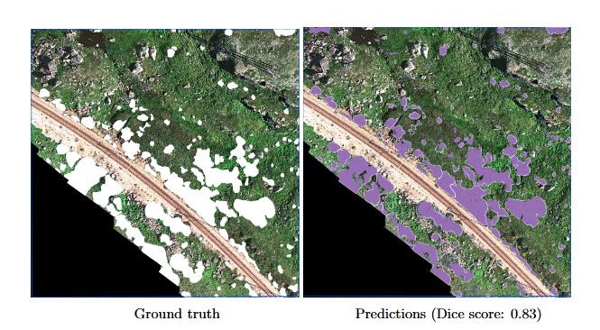
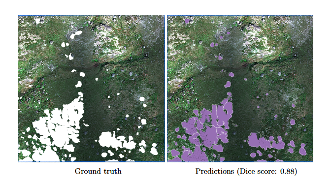
3 Model Results on the Test Areas
Here are visual representation of the results on two of the test areas, using the model which offered the best and most stable performance during validation. It is a DeepLabV3 model, using a ResNet-50 backbone as feature encoder, and using tiles of 786×786 pixels. Below (Fig. 4–5), we show the model’s performance when predicting on unseen images. The ground truth images show willows as mapped manually, which was done with help of the field mapping.
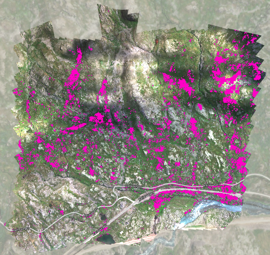
4 Running the Model on the Whole Finse Drone Survey
Here are preliminary results showing what we obtain from running the model on the whole study area — for illustrative purposes only!